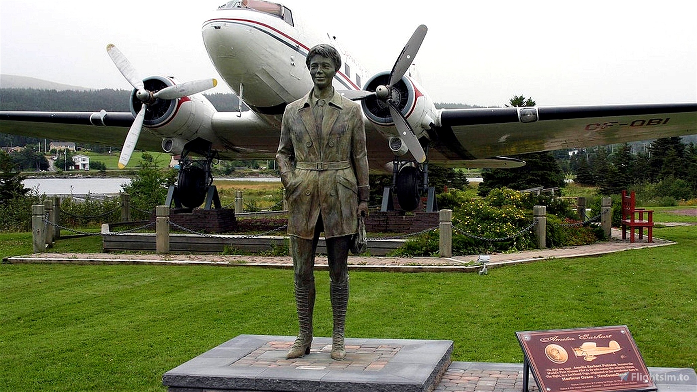
Amelia Earhart's circumnavigation of the globe in 1937
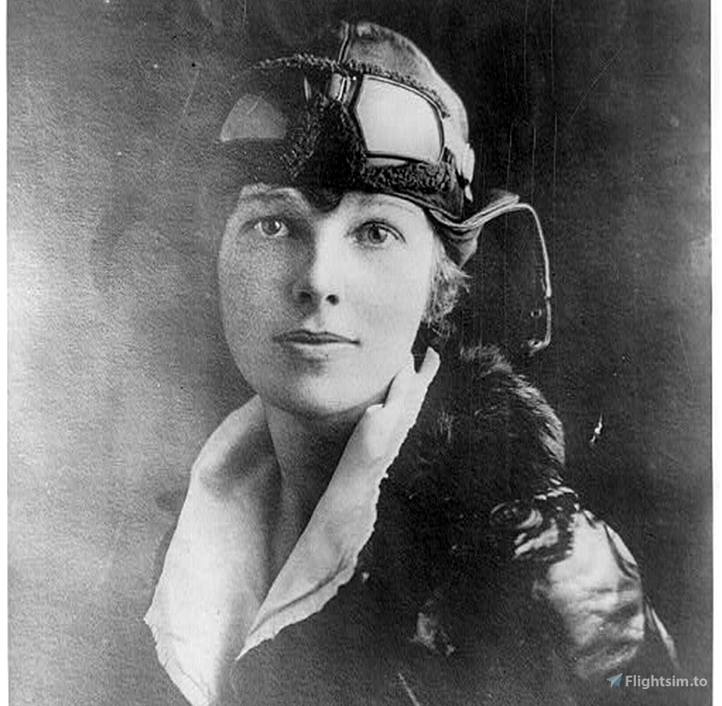
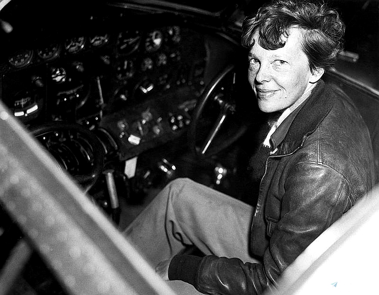
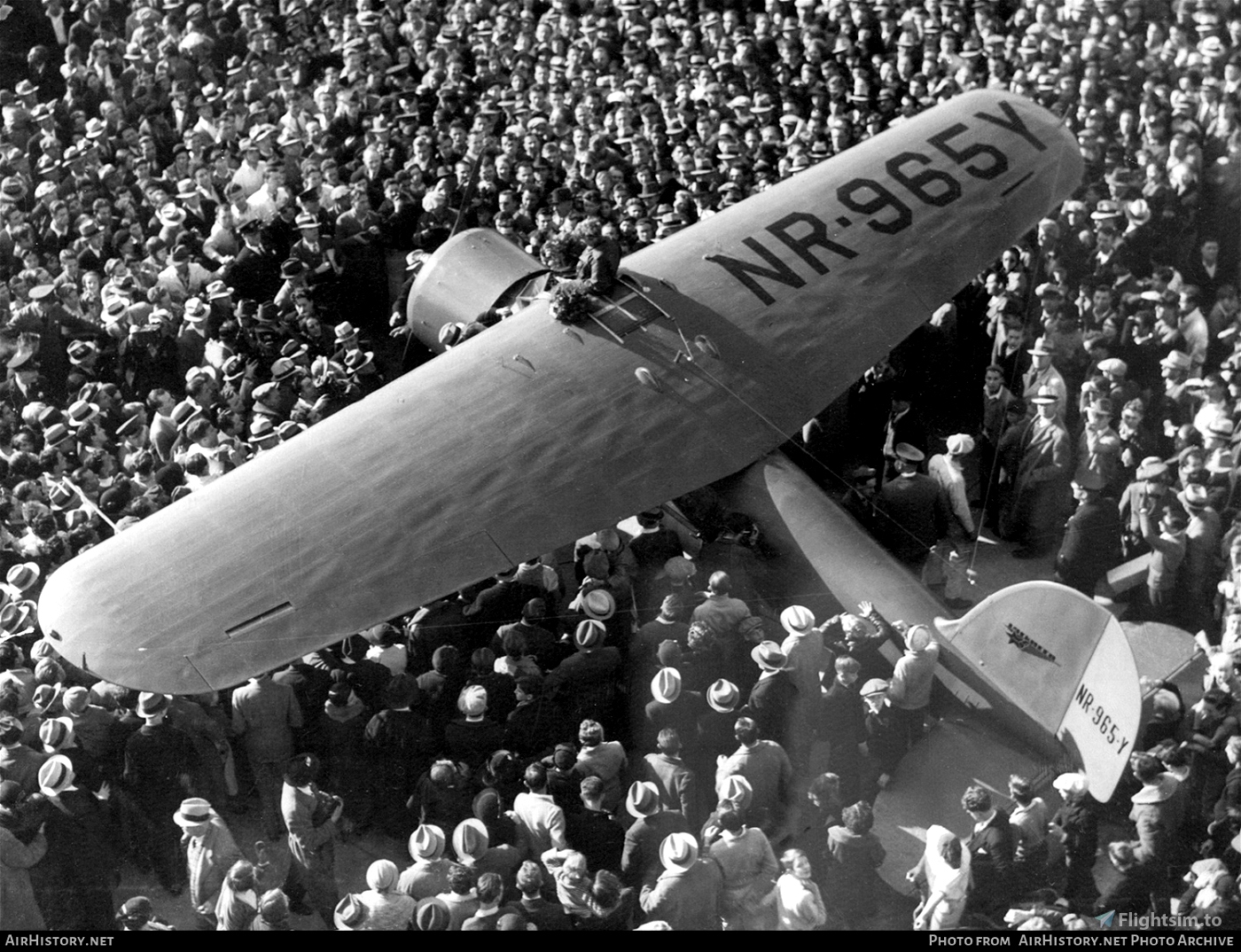
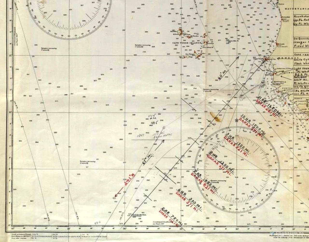
Amelia Earhart, a U.S. aviation pioneer and fighter for women's rights, was the 16th woman to become a licensed pilot. She was the first woman to cross the Atlantic in an airplane, with a team, and shortly thereafter she completed the distance flying solo. Amelia Earhart set several altitude, distance and speed records. Thus, she was able to prove that women are also capable of doing things that were exclusively reserved for men in her time. Amelia Earhart is best known for her attempt to fly around the world in 1937 with navigator Frederick J. Noonan in her Lockheed Electra 10E Special. They disappeared on July 2, 1937, en route from Lae, New Guinea, to Howland Island in the Central Pacific. The large-scale search for her and her navigator was unsuccessful. What happened to her and Noonan remains a mystery to this day.
This flight is dedicated to the memory of Amelia Mary Earhart and Frederick Joseph Noonan.
There is already a flight with the same theme at https://flightsim.to/file/6130/amelia-earhart-ultimate-bush-trip. However, there are a few differences:
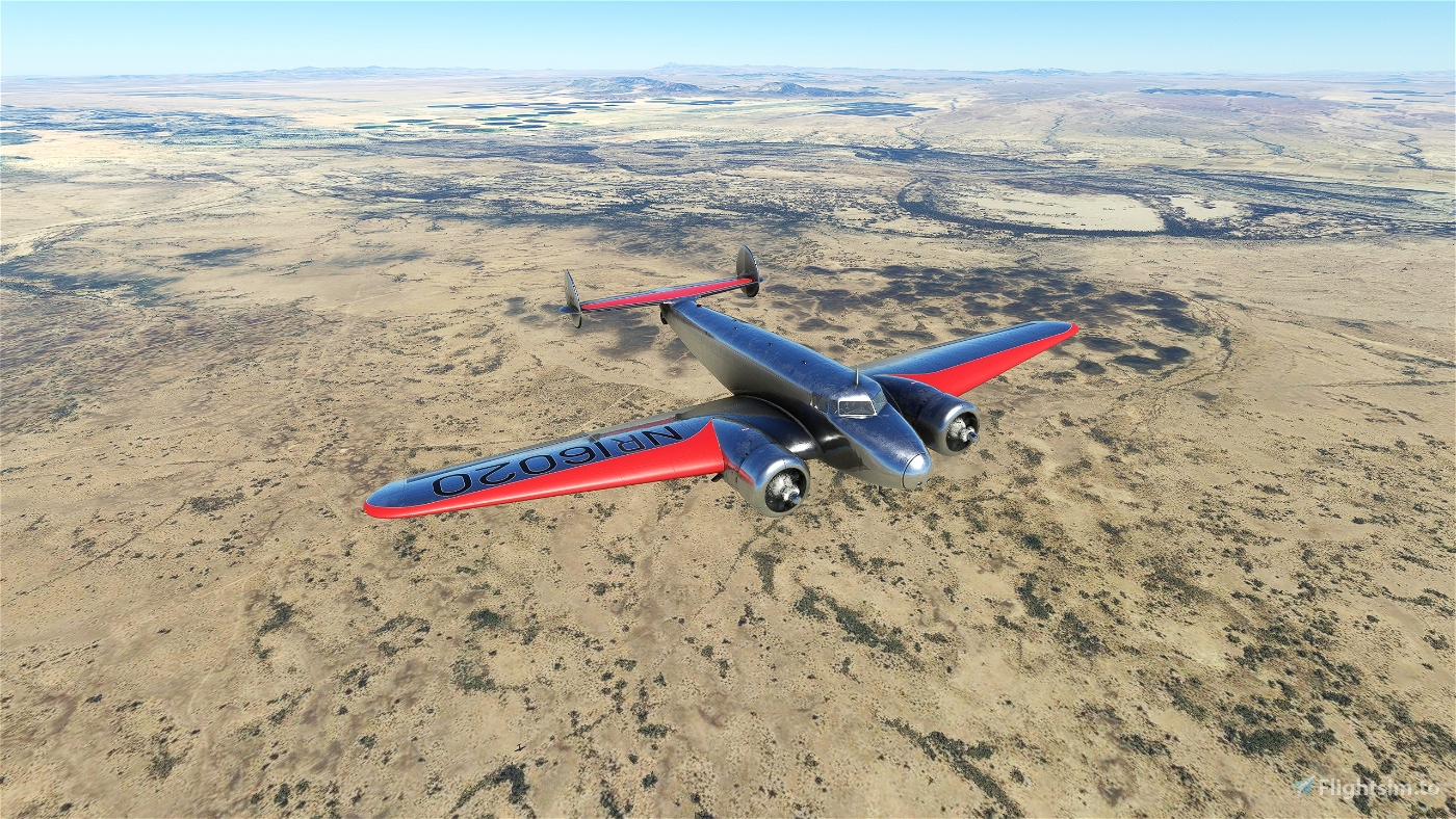
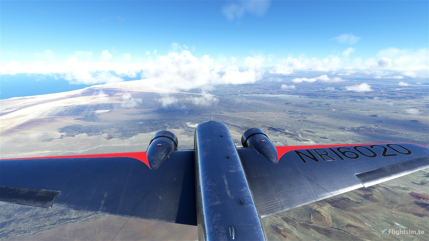
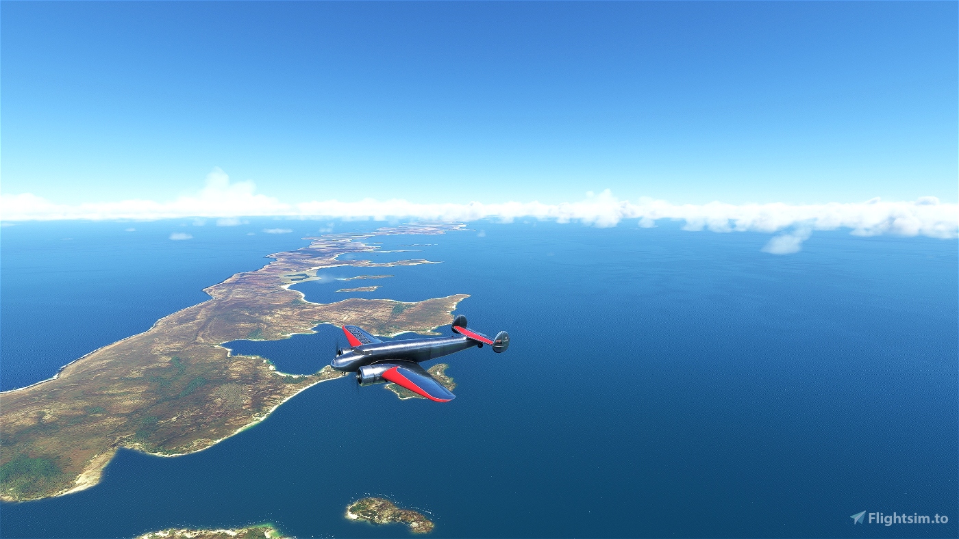
- You can make this trip with the Lockheed Electra 10E, NR16020, which also piloted Amelia Earhart and is now available as payware.
- The texts are multilingual, i.e. machine translated into all languages offered by the MSFS, except Japanese and Chinese. Therefore there may be translation errors. If you find such, please feel free to send me the corrections for them.
- For each language there is a flight book with all translated texts.
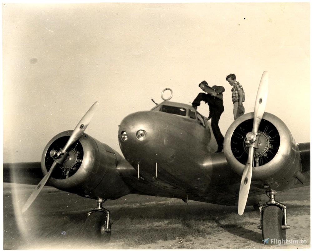
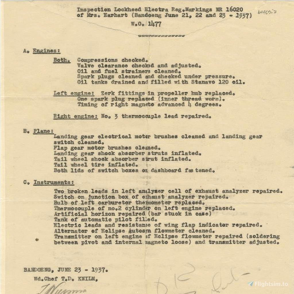
- The trip is more extensively researched; there is more background information, reviews of previous successes, and a number of historical photographs.
- As far as possible, I have tried to reconstruct the routing from Amelia Earhart's notes.
- In the second part, which Earhart and Noonan were no longer able to fly, there are a number of hypotheses about the disappearance of the two aviation pioneers.
Specification:
- The entire trip consists of 2 parts and covers 22,000 NM with 21 legs.
- The best part is that you don't have to sit in front of the screen for 18 hours for more than 2,000 miles per leg. There are a number of blank waypoints inserted (approximately every 200-250 NM). After each waypoint, the flight is saved in the cloud so that it can be stopped at that point and continued later. The flight then starts in the air, at the last waypoint flown over.
- If you don't have a second screen and can't log the flight with LNM or another map, or can't get to the destination due to a lack of navigation skills, you can turn on widely visible markers in the "Support Options / Navigation Aids / Route and Waypoints" to head for.
- The aircraft is interchangeable with some manual work, see exchange file. Alternatively there is the MissionChanger from BuffyGC.
- The flight plan is included in the package as PLN file, for example for LittleNavmap. This makes it possible, in conjunction with the flightlog, to make this trip with increased simulation rate also as a free flight, without executing it as a bush trip.
- Not all airports from the time of 1937 are available anymore. You will then land at the nearest airport.
- Enough gasoline can be refueled in the Lockheed Electra 10E to cover more than 2,000 nautical miles.
- The "Load and Refuel" button is available at airports that offer gasoline.
- Weather is freely selectable and customizable. Live weather is preset. Time can also be adjusted in the weather menu.
- Use ATC if you like.
- Put the plane in cold and dark after each landing.
- The addon can be used for multiplayer.
Necessary addons:
https://flightsim.to/file/28052/howland-island-kamakaiwi-field
https://secure.simmarket.com/aeroplane-heaven-electra-10a-msfs.phtml (Payware)
Recommended addons:
If you don't want to use the course and prefer to use the sextant to determine the location, you can use this ingenious addon:
https://flightsim.to/file/17738/celnav-for-msfs-celestial-navigation-sextant
Text and image sources:
https://www.thisdayinaviation.com
Special thanks to Bryan R. Swopes for collecting Amelia Earhart's notes and historical photos on his homepage.
Created with BushTripInjector by BuffyGC.
Amelia Erharts Weltumrundung 1937
Amelia Earhart, eine US-amerikanische Flugpionierin und Kämpferin für Frauenrechte, war die 16. Frau, die lizensierte Pilotin wurde. Als erste Frau überquerte sie in einem Flugzeug, mit einem Team, den Atlantik und kurz danach bewältigte sie diese Strecke im Alleinflug. Amelia Earhart stellte mehrere Höhen-, Strecken und Geschwindigkeitsrekorde auf. Damit konnte sie beweisen, dass auch Frauen dazu in der Lage sind, Dinge zu tun, die zu ihrer Zeit ausschließlich Männern vorbehalten waren. Amelia Earhart ist vor allem für ihren Versuch bekannt, 1937 mit dem Navigator Frederick J. Noonan in ihrer Lockheed Electra 10E Special, die Welt zu umrunden. Sie verschwanden am 2. Juli 1937 auf dem Weg von Lae, Neuguinea, nach Howland Island im Zentralpazifik. Die groß angelegte Suche nach ihr und ihrem Navigator blieb erfolglos. Was mit ihr und Noonan geschah, bleibt bis heute ein Rätsel.
Dieser Flug ist dem Andenken von Amelia Mary Earhart und Frederick Joseph Noonan gewidmet.
Auf https://flightsim.to/file/6130/amelia-earhart-ultimate-bush-trip gibt es bereits eine Flugreise mit dem gleichen Thema. Es gibt aber ein paar Unterschiede:
- Du kannst diese Reise mit der Lockheed Electra 10E, NR16020, die auch Amelia Earhart gesteuert hat und mittlerweile als Payware erhältlich ist, unternehmen.
- Die Texte sind multilingual, also in alle Sprachen maschinell übersetzt, die der MSFS anbietet, außer japanisch und chinesisch. Von daher kann es zu Übersetzungsfehlern kommen. Wer solche findet, kann mir gerne die Korrekturen dafür schicken.
- Für jede Sprache gibt es ein Flugbuch mit allen übersetzten Texten.
- Die Reise ist umfangreicher recherchiert; es gibt mehr Hintergrundinformationen, Rückblicke auf vorherige Erfolge und eine Reihe von historischen Fotografien.
- Soweit dies möglich war, habe ich versucht, die Streckenführung aus den Aufzeichnungen von Amelia Earhart zu rekonstruieren.
- Im zweiten Teil, den Earhart und Noonan nicht mehr fliegen konnten, gibt es eine Reihe von Hypothesen zum Verschwinden der beiden Flugpioniere.
Spezifikation:
- Der gesamte Trip besteht aus 2 Teilen und führt mit 21 Etappen über 22.000 NM.
- Das Beste: Du musst bei mehr als 2.000 Meilen pro Etappe nicht 18 Stunden vor dem Bildschirm sitzen. Es sind eine Reihe von leeren Wegpunkten eingefügt (circa alle 200-250 NM). Nach jedem Wegpunkt wird der Flug in der Cloud gespeichert, so dass er an der Stelle abgebrochen und später fortgesetzt werden kann. Der Flug beginnt dann in der Luft, am letzten überflogenen Wegpunkt.
- Wer keinen zweiten Bildschirm hat und den Flug nicht mit LNM oder einer anderen Karte mitloggen oder mangels fehlender Navigationskenntnisse zum Ziel gelangt, kann in den "Unterstützungsoptionen / Navigationshilfen / Route und Wegpunkte" weit sichtbare Markierungen einschalten, auf die man zusteuern kann.
- Das Flugzeug ist mit etwas Handarbeit austauschbar, siehe Exchange-Datei. Alternativ gibt es dazu auch den MissionChanger von BuffyGC.
- Der Flugplan ist als PLN-Datei, für zum Beispiel LittleNavmap, im Paket enthalten. Damit ist es möglich, in Zusammenwirken mit dem Flugbuch, diese Reise mit erhöhter Simulationsrate auch als Freiflug zu unternehmen, ohne ihn als Wildnisflug auszuführen.
- Es sind nicht mehr alle Flughäfen aus der Zeit von 1937 vorhanden. Du landest dann auf dem nächstgelegenen Flughafen.
- Es kann mit der Lockheed Electra 10E genügend Benzin getankt werden, um mehr als 2.000 nautische Meilen zurückzulegen.
- Der Button „Beladen und Tanken“ steht auf Flughäfen zur Verfügung, die Benzin anbieten.
- Das Wetter ist frei wählbar und anpassbar. Live-Wetter ist voreingestellt. Im Wettermenü kann auch die Zeit angepasst werden.
- Nutze ATC, wenn du magst.
- Stelle das Flugzeug nach jeder Landung kalt und dunkel ab.
- Das Addon kann für Multiplayer genutzt werden.

 Koschi


in Amelia Earhart Bush Trip, does anyone have same experience as me in trip not recognising completion of leg 3 (KNEW New Orleans) ?
12 months ago
I tested it again and the landing trigger went off and ended the leg. I can only think of one thing to do: Have you downloaded and installed or activated the airfield HOWL?
https://flightsim.to/file/28052/howland-island-kamakaiwi-field
12 months ago
Koschi
Gdnross
Great, Tx!
1 years ago
Ginete