


Check the Google Map here for information related to the airports included in this scenery, e.g. ident under which the airports can be found in MSFS (always the two-letter ICAOs), NDB and RRN frequencies.
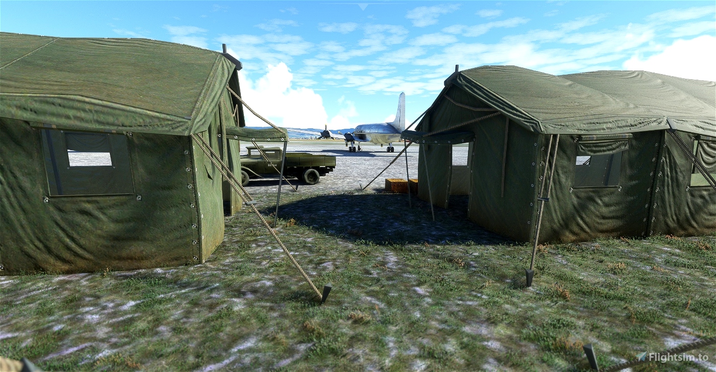
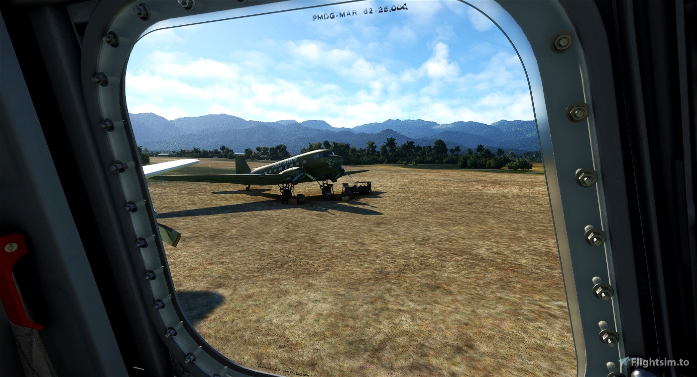
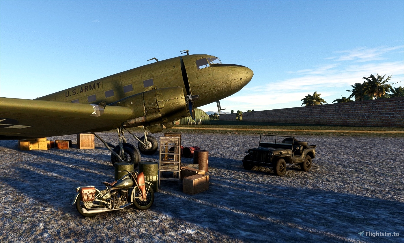
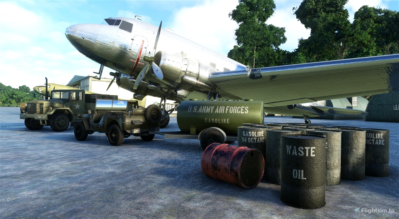
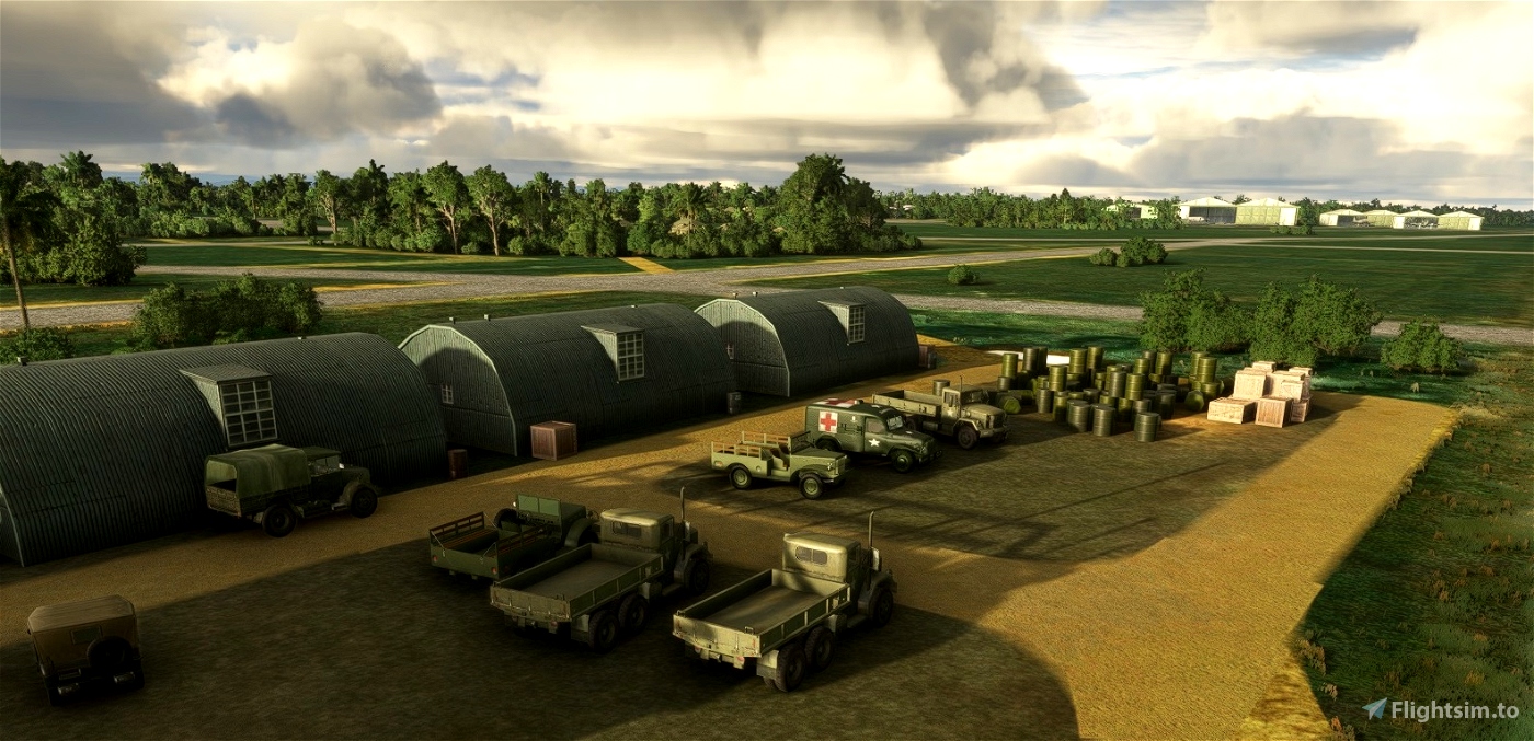
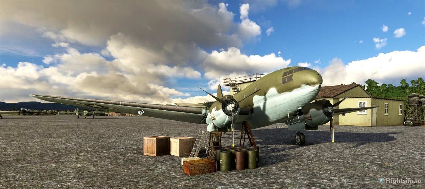
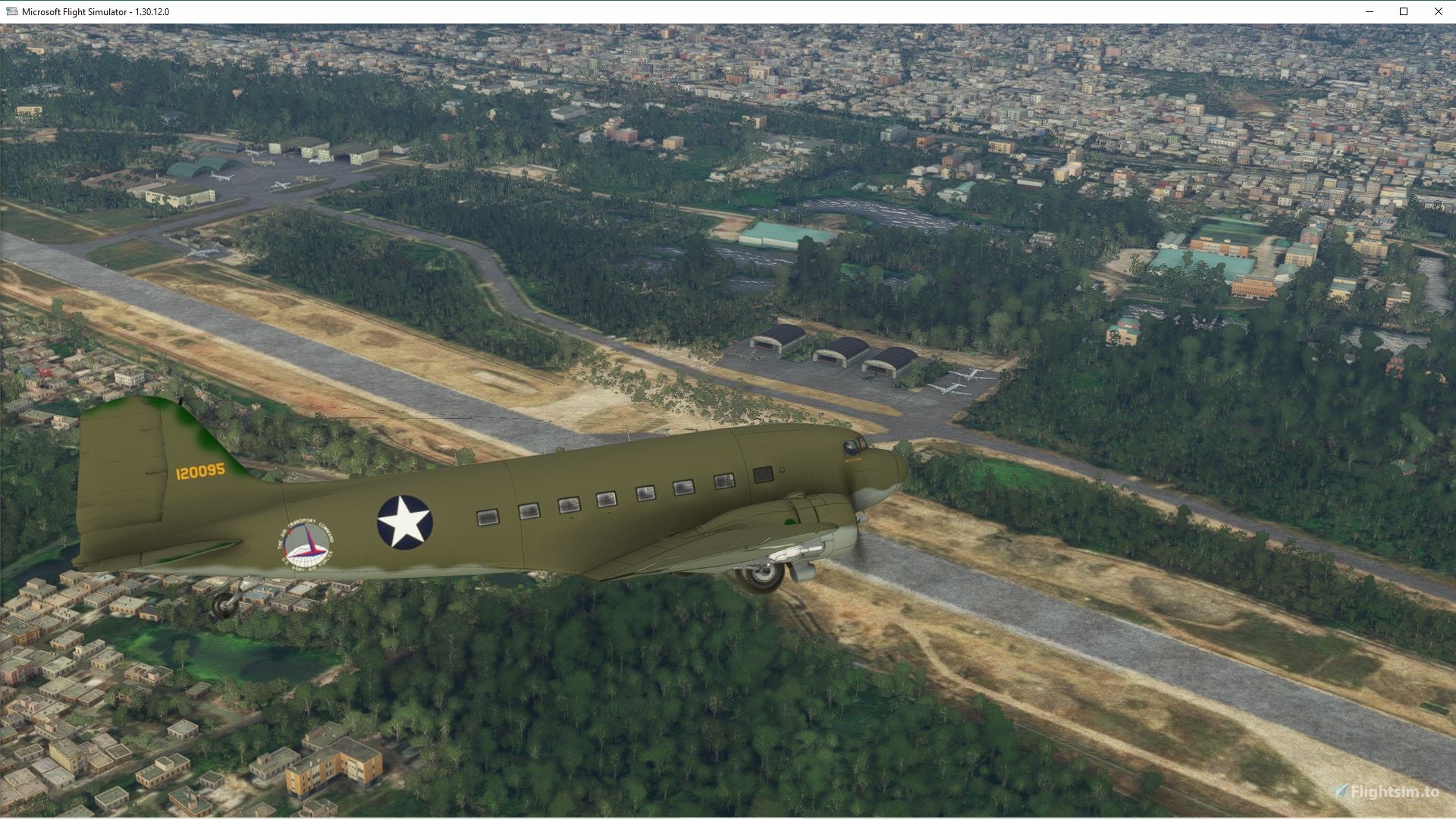
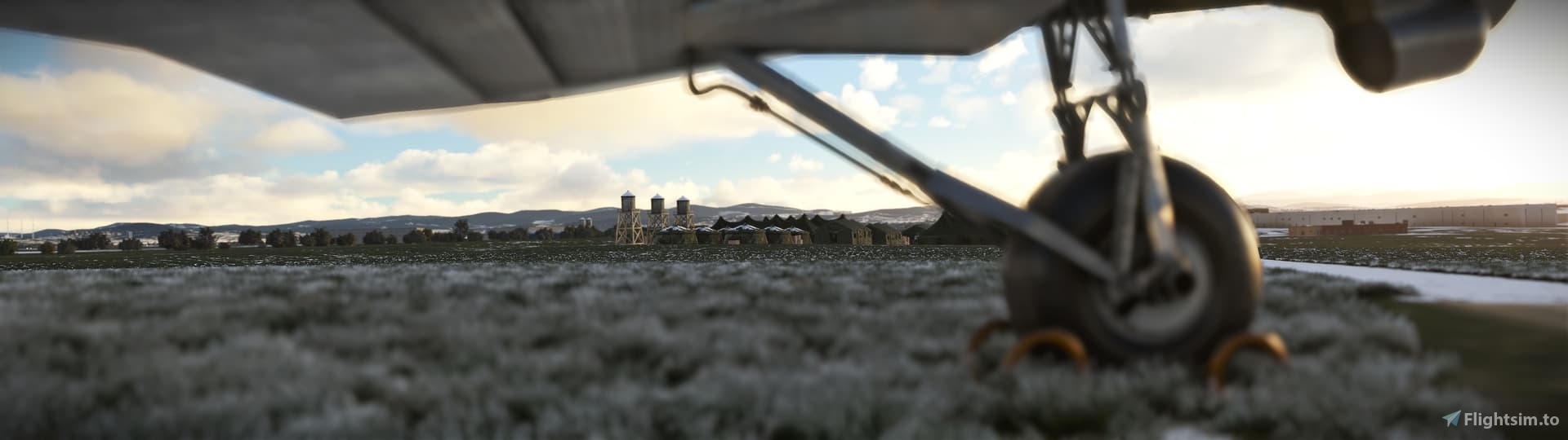
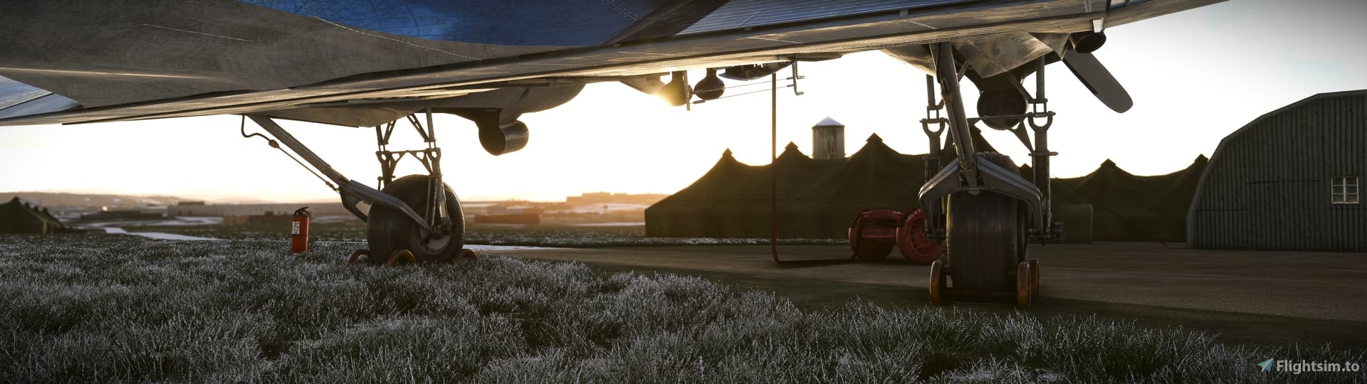
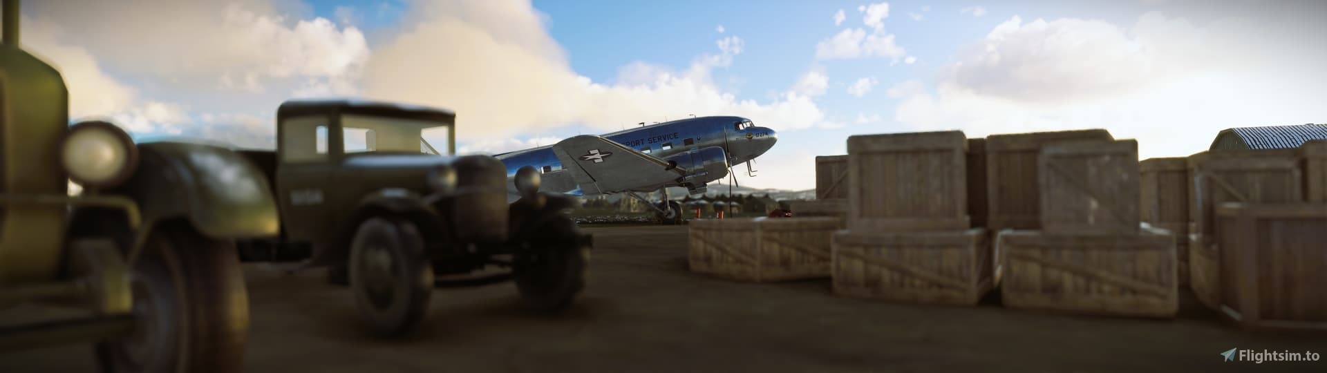
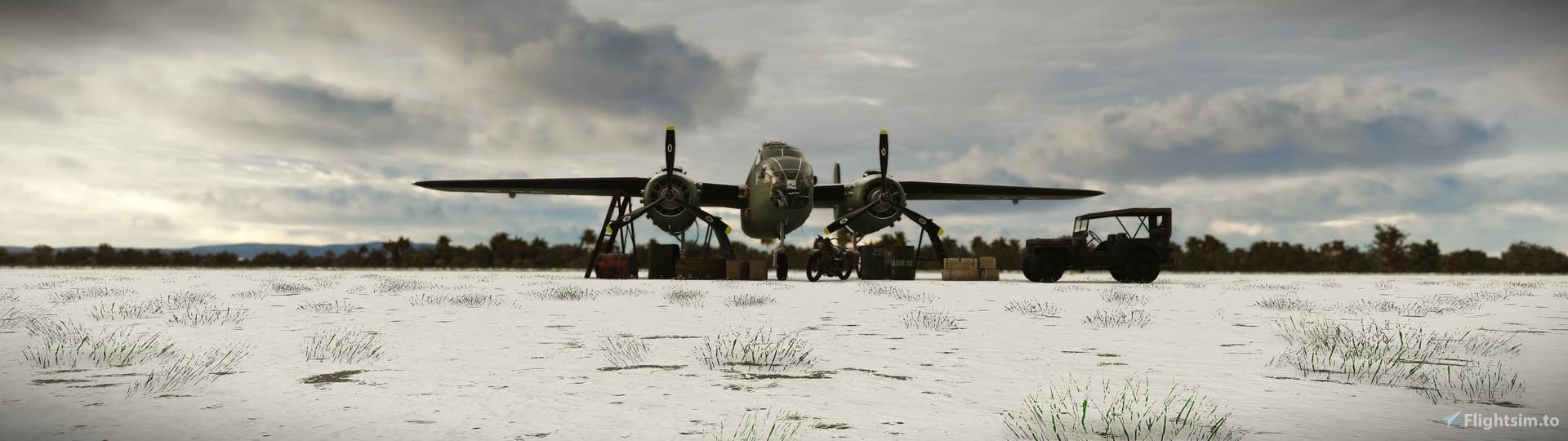
Flying the Hump is a scenery package for MSFS that aims to reconstruct main airfields of the CBI Theater (China-Burma-India) in a way that allows for flying the standard airlift routes.
The Hump was the name given by Allied pilots in the Second World War to the eastern end of the Himalayan Mountains over which they flew military transport aircraft from India to China to resupply the Chinese war effort of Chiang Kai-shek and the units of the United States Army Air Forces (USAAF) based in China. Creating an airlift presented the USAAF a considerable challenge in 1942: it had no units trained or equipped for moving cargo, and no airfields existed in the China Burma India Theater (CBI) for basing the large number of transports that would be needed. Flying over the Himalayas was extremely dangerous and made more difficult by a lack of reliable charts, an absence of radio navigation aids, and a dearth of information about the weather. (Wikipedia)
Installation
Extract and copy to Community folder either a version
- without runway lights (for day-only flights), or
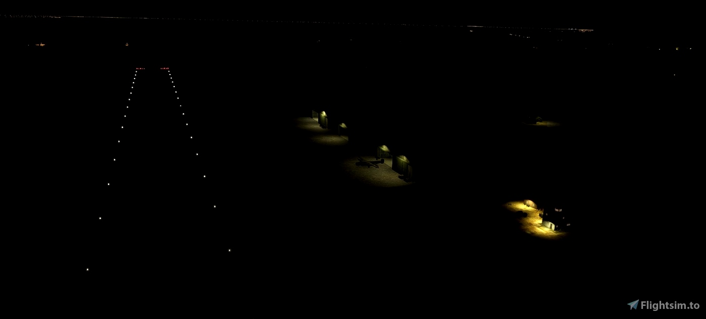
- with runway lights for night and low-visibility operations.
This is a workaround to deal with the default MSFS runway lights which are coded to be always on, even during the day and in good visibility conditions.
Scenery is optimized for ORBX Himalaya and Central Asia Mesh, though it should work also without it.
For better appearance, bring the Road Vehicles slider in Traffic tab in General Options to 0.
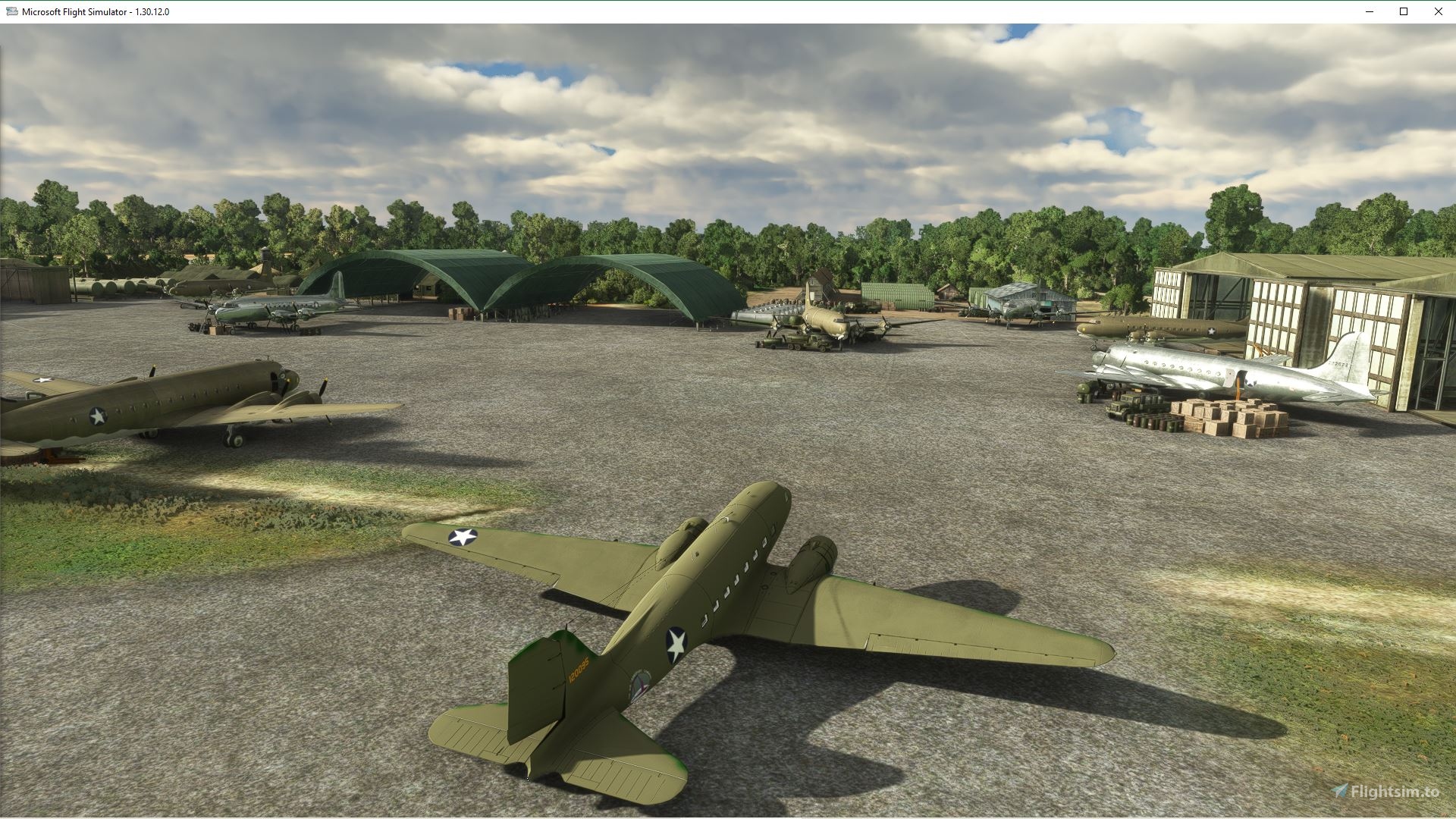
Content of the scenery package
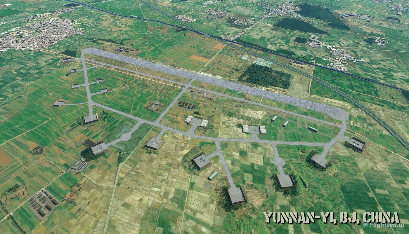
Flying the Hump scenery builds on the latest (March 2011) version of the China Burma India Malaya and N.E.I. WWII airfields released for FSX by Alex D. Nicolson, and adapts a subset of 58 airfields for MSFS.
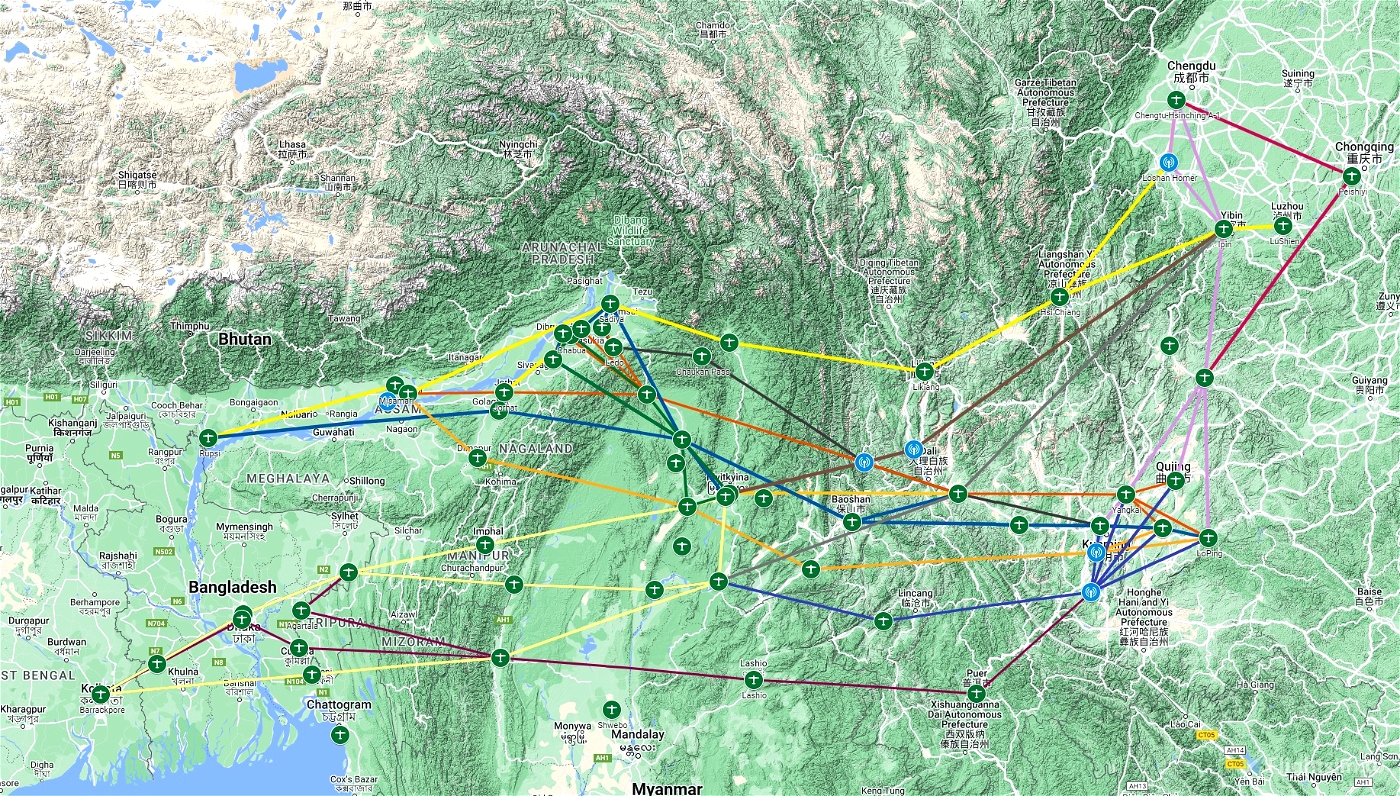
As a result, all airfields (serving either as terminal or as waypoint airfields) along the standard airlift routes as flown in July 1945 are included in the Flying the Hump scenery and therefore it is possible to fly the routes depicted on the map refered below.
Important Note: Historical sources differ when it comes to NDB frequencies. Therefore, this scenery uses the Assam-Bengal-China Air Routes maps as source with the highest priority and if not available, the information listed in the DC-3 Airways Virtual Airline “Hump” charter. To be sure, check the info on the Google Map created especially for this scenery. All these three sources are referenced further down in this readme.
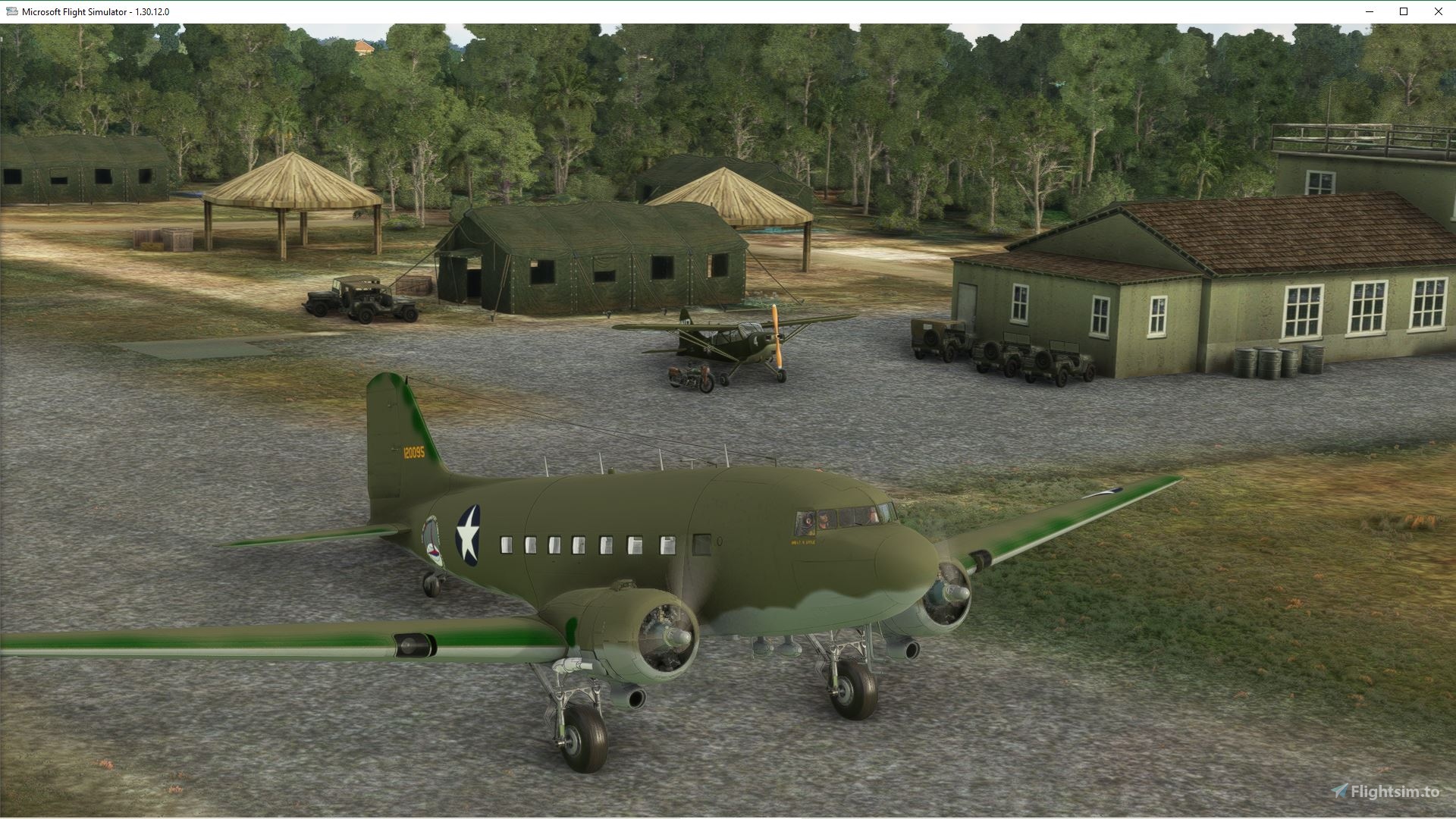
The scenery includes 58 airfields that complete the following routes: Able, Baker, Charlie, Easy, Fox, King, Love, Mike, Nan, Oboe, Peter, Roger and Shuttle. Airfields are (related ident codes are in the brackets):
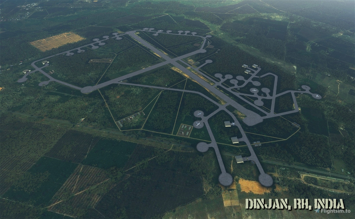
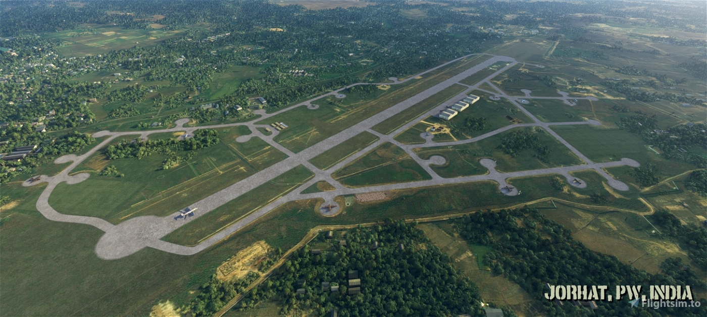
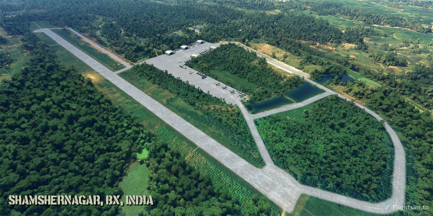
India: Agartala (UN), Barrackpore (CM), Chabua (VG), Chaukan Pass (CQ), Chittagong (NR), Comilla (RA), Dinjan (RH), Fenny (KK), Golaghat (EL), Imphal Tulihal (OM), Jessore (ZN), Jorhat (PW), Kurmitola (GI), Ledo (ZA), Manipur Road (FO), Misamari (QK), Mohanbari (KC), Moran (LX), Rupsi (DO), Sadiya (OR), Shamshernagar (BX), Sookerating (OH), Tezgaon (CV) and Tezpur (YP).
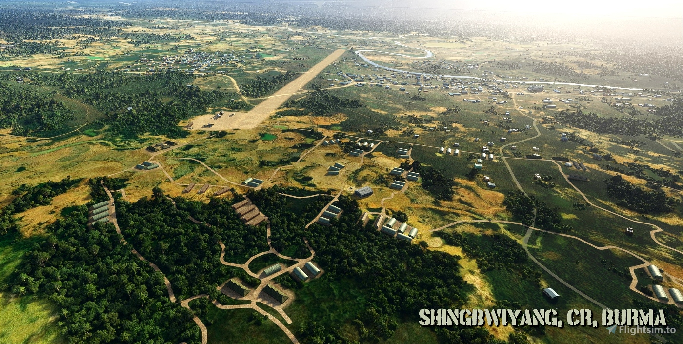
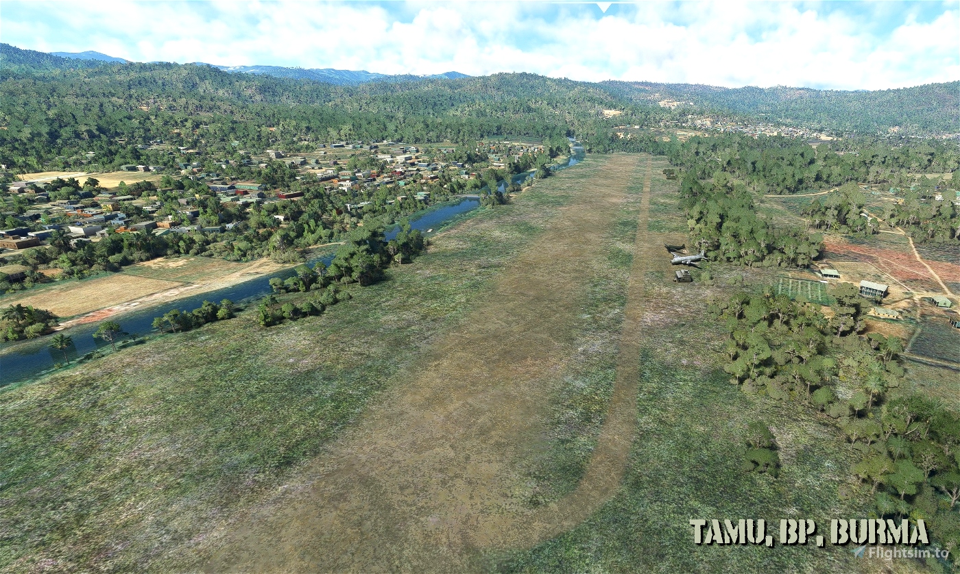
Burma: Bhamo (CN), Broadway (CBW), Fort Harrison (FHR), Ft Hertz (DH), Indainggale (HW), Katha (KQ), Lashio (FK), Myitkyina North (YO), Myitkyina South (FC), Sahmaw (FJ), Shingbwiyang (CR), Shwebo (HQ), Tamu (BP), Tingkwak Sakan (ID) and Warazup (LR).
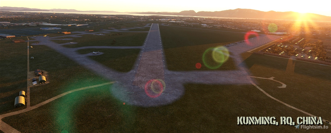
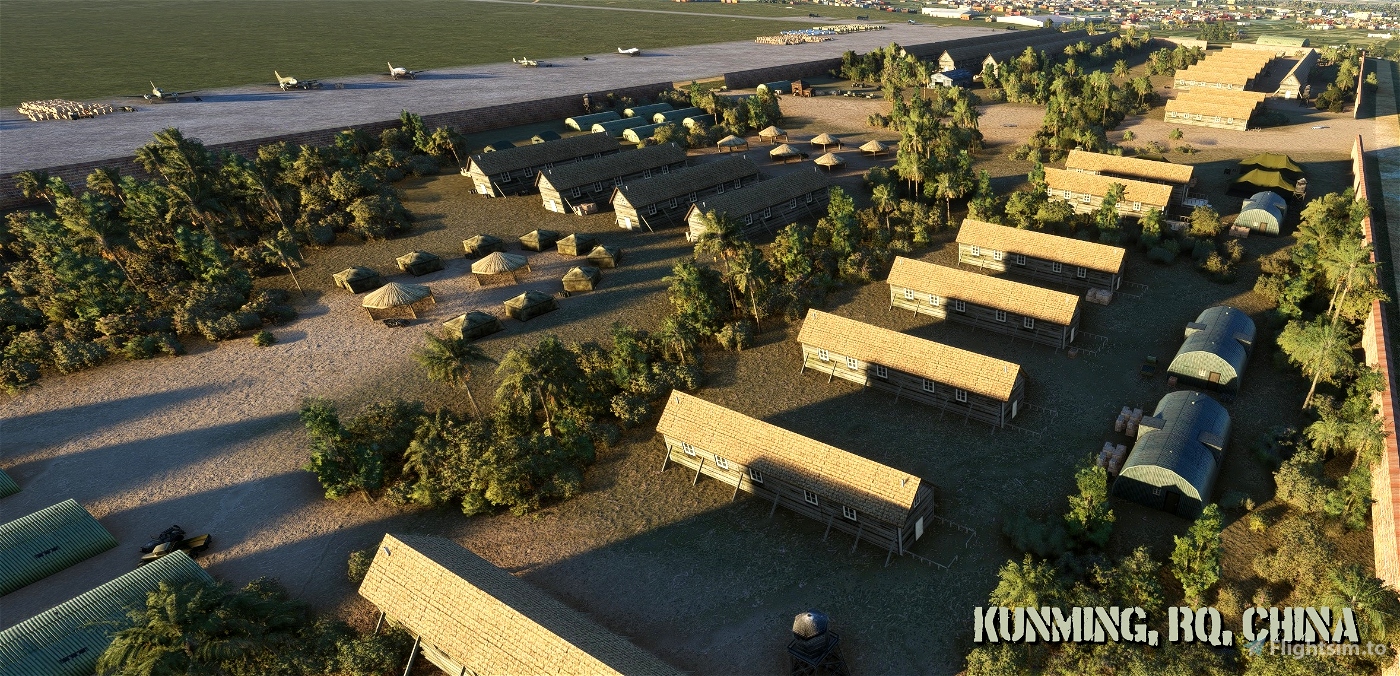
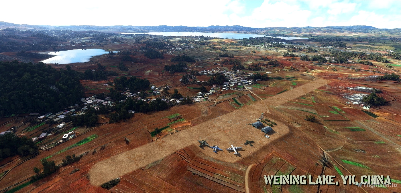
China: Chaotung (CT), Chanyi (CY), Chengtu-Hsinching A-1 (CU), Hsi Chiang (LB), Ipin (VM), Kunming (RQ), Likiang (DM), LoPing (HP), LuLiang (IM), LuShien (ON), Mangshih (XU), Mengsa (SN), Paoshan (SW), Peishiyi (PY), Szemao (LP), Tsuyung (IX), Weining Lake (YK), Yangkai (CP) and Yunnan-Yi (BJ).
Homer-only beacons: Chih Hu Lake Homer (CG), Kunyang Homer (GV), Loshan Homer (IF), Singri Homer (LD), Tengchwan Homer (FY) and Yunlung Homer (YU).
Routes and Airport Charts Documentation
In order to bring all the essential information to one place, this scenery package includes a pdf with:
- Assam-Bengal-China Air Routes (source: www.cbi-theater.com), and
- CBI Instrument Letdown & Departure Procedures (source: original WW2 publication of the same title complemented with a few charts found online).
Radio Range Navigation
The scenery properly implements Radio Range Navigation (RRN) beacons located at Barrackpore (CM), Chabua (VG), Chengtu-Hsinching (CU), Jorhat (PW), Kunming (RQ), and Tezpur (YP). You can fly RRN using the RRN stand-alone mod by ElectronVolt, however you need to update the RRN beacon database by replacing the original stationslist.csv located within the MSFS FlyingTheBeam folder with the one included in this scenery. To update your LittleNavMap, use the stationslist_LNM.csv file.
Remarks:
For ease of navigation, the RRN beacons are also implemented as NDBs with the same frequency as the RRN beacons. The choice whether to use them is up to you.
If you want to fly RRN with the Boeing 247D, you need to use the standalone mod by ElectronVolt with updated database since it is not possible to update the internal Boeing 247D RRN beacon database.
Essential Resources
CBIXv1 from Alex D. Nicolson - Original files for FSX. The zip contains also useful maps and approach charts and other info.
DC-3 Airways Virtual Airline “Hump” charter - At the bottom of this charter webpage is a link to a file that contains useful information well worth consulting when flying over the Hump, including a detailed description of how to fly each route.
Assam-Bengal-China Air Routes - Maps of the original Hump airlift routes together with relevant nav information. Check also the homepage as the website is a great source of CBI Theater related information.
And of course there is countless articles, accounts, books and videos about the Hump online.
Acknowledgements and Credits
Thank You goes primarily to Alex D. Nicolson for his hard work of creating the original CBI files and his permission to use his work for this Flying the Hump scenery.
Thank You goes of course to all 3D model designers who created various assets useful for Flying the Hump scenery and who made these models available to the community. This scenery is using their models bona fide and in line with their conditions. These 3D model deisgners are: Libardo Guzman García, Greg Pepper, Tim Gibson, Enrique Medal (C-46); Jens B. Kristensen (C-54); Phil Perrott, Jim Nelson, Jaap de Baare, Glen Duncan, Michael Pook (C-87); Mike Stone, Garry J. Smith, Bob Chicilo (B-25); JR Lucariny FSModels (StinsonL5S); Shawn Lund, Pete Clayson (R-4B); Antonio R., Arion Digital, Austro, bishmael97, MattyNL, mohaiba, Urecky (vehicles); (Dodge33) - AJ, »Photogenic«, ColdCanuck60, CrazycatDev, Jason W., Jonan Art, Jorma Rysky, LuddePudde, Martin C., Mike, petronio Uy bigornia jr, saurabhkumarshashi, seafore, Yannick Weber (clutter).
And a big Thank You goes also to Arno Gerretsen, author of ModelConverterX and to the community developing and supporting Blender.
Flight Simulator 2020 / Flight Simulator X © Microsoft Corporation. Flying the Hump was created under Microsoft's "Game Content Usage Rules" using assets from Microsoft Flight Simulator X and it is not endorsed by or affiliated with Microsoft.
Microsoft's Rules: https://www.xbox.com/en-US/developers/rules.
Disclaimer / Copyright
This scenery is uploaded to flightsim.to exclusively and upload to other websites is forbidden without a written approval of the author.
The author of this package, as well as the author of the original scenery, is not responsible for any damage caused by the use of this package.
This package is free. It is forbidden to distribute it (wholly or partially) for commercial purposes without approval of the author of this package and the author of the original scenery. Furthermore, it is forbidden to alter parts of the sceneries and / or use them in other sceneries without a written approval of the authors.
January 2023
version 1.1.0


Awesome! Thanks a lot for all your hard work, really appreciated. There's only one (strange) thing - as soon as i have my Navigraph AIRAC Data enabled, all the NDBs added by this mod here disappear. Not sure why yet
10 months ago
Thank you for the positive feedback.
Regarding the disappearing navaids: unfortunately I think it is the way navigraph data work - they delete prevent all other navaids.
10 months ago
apollon01
cdc455
Hi ! There might be an issue with the Google Map link.
I receive a server error message and nothing appears each time I try to access it.
Can you please check if everything is fine with it?
Thank you!
1 years ago
It seems to be an issue across the board - none of the google maps I am trying to access works. Try to check it later.
1 years ago
apollon01
Mezcla47
Bonjour, merci de France. Trés belle aventure et grande page d'histoire. Merci pour ce remarquable travail. Je fais de petites étapes.
1 years ago
PAPYDANIEL66
Alguien me puede ayudar a como empezar, rutas y demas, me he debido liar y no se como volar. Gracias
1 years ago
yo tengo un grupo de amigos que entre nostros te podriamos ayudar a como empezar en el sinmulador, visita estos canales en twitch, @bluezonian , @Nicaboss
11 months ago
MrComepavos
cenizosa50
merci
1 years ago
moustik22
Thank you so much for your work and dedication!
I have been exclusively flying these for the past month and I am loving it.
Each leg has its surprises and challenges, and I discover each new airstrip with amazement as I come to land and then taxi to find a spot where I can park. All the details are perfect and it's all so immersive! Actually, I am only playing MFS2020 for the DC-3 and for your Hump routes, a thousand thanks again!
A very grateful Hump pilot reenactor.
1 years ago
Thank you for your kind words.
It is this kind of feedback that makes all the hundreds of hours spent on making this scenery worthwhile :-)
1 years ago
apollon01
Mezcla47
Where can you find the C-46 for FS2020, ive been looking under every rock. I would like to fly this amazing addon with both DC-3 and C-46
1 years ago
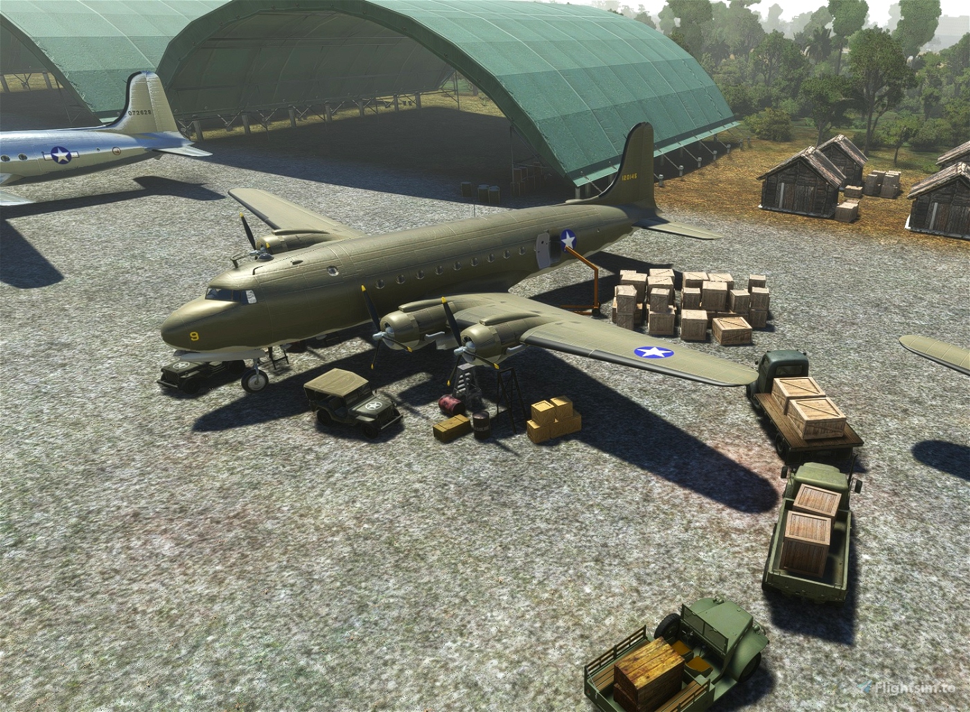
The C-46 that you can see on the screenshots is a static aircraft only. Sorry.
Once a decent C-46 is released for MSFS, I am the first one to buy :-)
1 years ago
apollon01
captainsmuggle
Great, Tx!
1 years ago
Ginete
Thanks again. Great work.
FP using your scenery as the prerequisite for this CBI Series of excursions:
FP: https://flightsim.to/file/45890/flying-the-hump-cbi-supply-transport-routes-of-the-stilwell-and-ledo-roads
Our new historical/vintage/WWII virtual airline is now up and running- effective today (Dec 13, 2022) >> http://www.wwbpa.net/
1 years ago
Great to hear it, Norm :-)
1 years ago
apollon01
nbrich1
Just to let you know Apollon, the website wwbpa.net is now live. All of your software has been converted to "tours" and is available to fly as a virtual airline. We are looking forward to adding the final airports as they are ready and a really big THANK YOU for making all of this happen. Please come over and visit us!... (I changed this as the original link and redirect didn't work....sorry) Up and running.....the tours are great.
1 years ago
Thanks for your kind words :-)
I am now finishing the last few airstrips and then will release v1.0.0.
I am happy the scenery will be used in your VA. Good luck with that!
1 years ago
apollon01
MFC0001
Great package 🙏
1 years ago
sthienard
FANTASTIC, Thank you so much. With this update, we are almost ready to launch the VA that will concentrate on WW2 and the Hump. Your scenery has made this project possible. Expect the website to be active in a week or less.
1 years ago
MFC0001
Thanks for the update and the great work so far,
I was thinking a discord channel dedicated for the Hump so pilots can fly sorties together. Whats everyones thoughts?
1 years ago
York77
No Morse code. I know this is an Asobo problem but maybe if everyone upvotes the missing nav audio in the bug reporting site we can get the ADF sounds to work. I cast my vote the other night.
1 years ago
I got a morse code in DC-3. Though a very quiet one. Did you switch the ADF audio ON on the audio panel overhead?
1 years ago
apollon01
WAG
This is an absolutely awesome project, thanks a lot!
1 years ago
Scooty