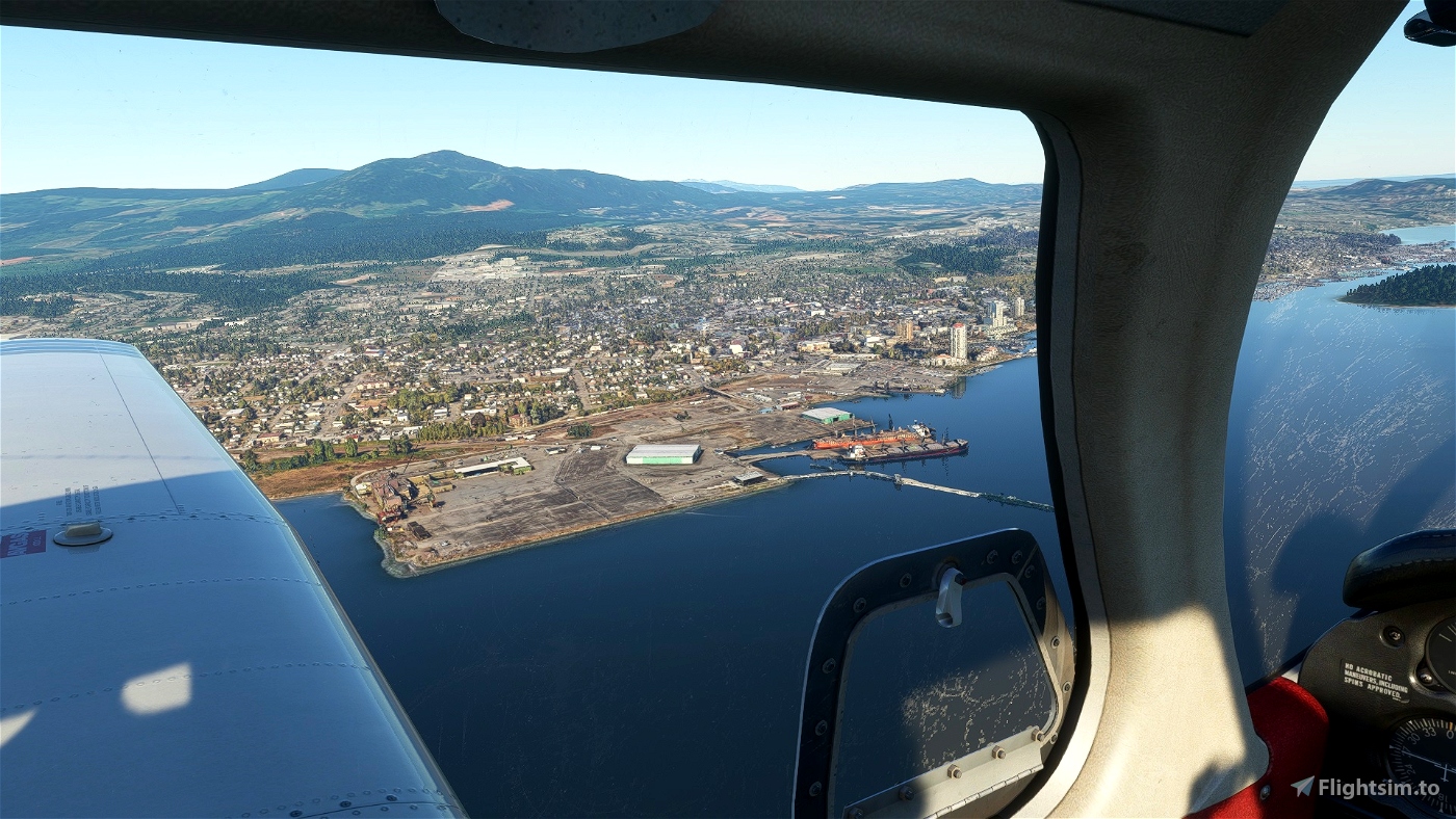
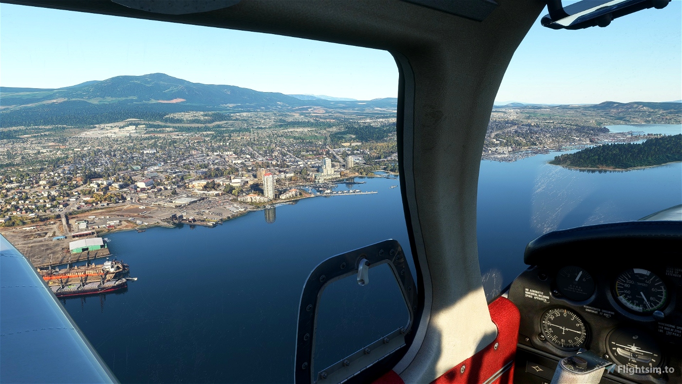
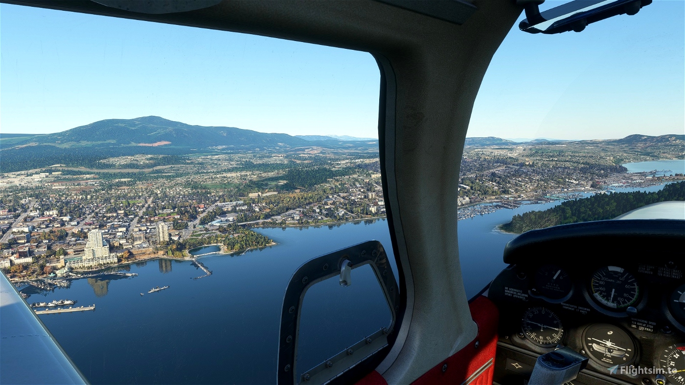
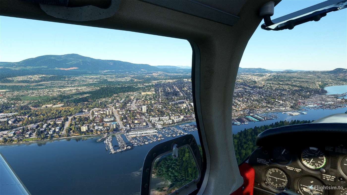
Enhance downtown Nanaimo using Google 3d data .
A note to those who expect Google photogrammetry would meet their need .
Google photogrammetry " ONLY " serves one purpose :
A good visual experience on daytime flyby of at least 1000 feet high .
That is it , nothing else .
Best regards
Minh .


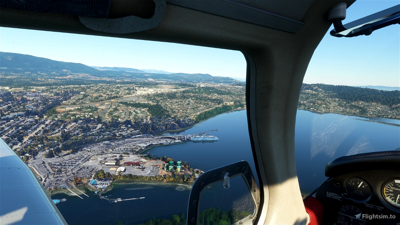
https://imgur.com/hJ36ZTk
No issues running this with the latest updates in 2024.
2 months ago
unhinged_aviator
I love this scenery but would you consider adding a bit more, and include the area with Costco all the way up to the "Nanaimo" sign at the north city limits?
2 years ago
Marionettework
My installation is a mess with shapes and oblongs of all types instead of buildings and scenery. Would this be due incompatibility with SU9?
2 years ago
Hi , Upon seeing your comment , I've taken a flight from CYCD to CAT4 . Nanaimo downtown just looks the same as in the pictures above . I don't know what's wrong with your instalation of the scenery . Google photogrammetry basically is just VERY BIG LOW POLYGON 3D MODELS that cover a very large area . It looks good only faraway like at least 1000 feet high . Since they are just very low polygon 3D models , they look very bad upclose .
2 years ago
Minhbui
YMA555
Thanks for a really nice airport. A pleasure to fly.
2 years ago
55tom55
This wonderful to have! Thank you!
The water around the ferry terminal does not blend well with the surrounding water.. can that be adjusted?
3 years ago
Thank you for your kind comment ! I already did my best . Without Vancouver Island mesh , they look like the screen shots above . But with Vancouver island mesh , They may look even worst .
2 years ago
Minhbui
BPieke
Excellent job thank you!!!
3 years ago
RepublicDC9
Amazing mod! I would say the only downside is if you are very close to the object you can see the texture and weird stuff flowing all over the place but from high altitude it is very good.
3 years ago
Ultiumx1782
Thank You! I'm across on Gabriola Island so this is home base or me. I'd love to see someone tackle the Gulf Islands and their floatplane bases
3 years ago
itsmehigh
This is awesome - between the elevation for all of VI and now a city photogametry project like this - hopefully you and Planeguy can keep working on these - my vote for Victoria - Port Alberni - Comox and Courtney please.
3 years ago
thank you !
3 years ago
Minhbui
72VirginExpress
Very nice, thank you. Lived there for ten years a long time ago.
3 years ago
Thank you !
3 years ago
Minhbui
Cessna777
Wow awesome, just north of home. Thanks!!!
3 years ago
Thanks !
3 years ago
Minhbui
Ibexto
Nice, my local area. Thanks!
3 years ago
Thanks !
3 years ago
Minhbui
jpen828
Thank you very much for this!
3 years ago
Thank you !
3 years ago
Minhbui
RichardPlantagenet
Very much love the scenery, very well done on a great job. One small point there appears to be water texture/level issues around the boats. Can this be fixed?
3 years ago
Thank you for your positive comment ! Google photogrammetry treats water as 3d models and are attached to boats and jetties . Jetties and small boats are very close to the water surface . At LOD19 , jetties and water are at the same height . In order to hide Google photogrammetry 3d water , jetties and small boats . We need to sink THEM beneath MSFS 2020 water surface . If we do that , they will be all disappeared . If we want jetties and small boats appear on top of MSFS 2020 water , Google 3d water also appear . I already deleted a lot of those 3d models water that are not attached to boats and jetties .
3 years ago
Minhbui
GBOAC
Fantastic! This is really going to kick those Nanaimo - Qualicum flights up a notch, thanks Minh!
3 years ago
Thank you Ken ! I am glad you like it . What about performance , any hits on FPS ?
3 years ago
Minhbui
Westcoaster